Opelika & Regional Connectivity
|
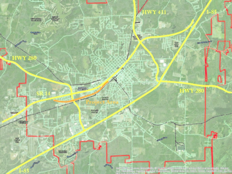
The City of Opelika is regionally connected by Interstate 85, US Highways 431 and 280, and State Route 14.
1st Avenue parallels State Route 14 between US Highways 431 and 280 and connects a mix of uses from downtown to western Opelika. Neighborhoods along its route include 16th Place, Westend, and Pepperell Village. In a 2010 transportation plan, it was designated a minor arterial with an average level of service or better (AOMPO). |
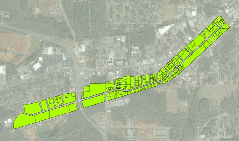
1st Ave project area
|
The project area is a two-mile section of 1st Avenue between downtown Opelika and the Pepperell Branch to the Tallapoosa River, approximately 210 acres.
|
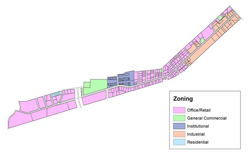
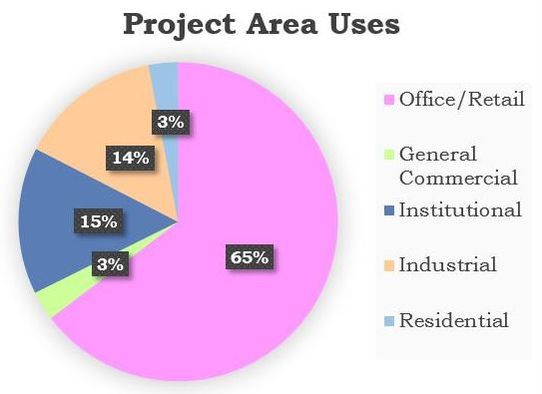
1st avenue land use
|
Current zoning includes Office/Retail (the vast majority), General Commercial, Institutional, Industrial, and Low Density Residential.
The majority Office/Retail zone allows for a wide range of uses that include small neighborhood retail, residential, banks, and convenience stores. Contrary to its prevalence in the project area, its wide variety of uses promotes limited continuity. |
|
1st avenue population
An estimated 250 people live in the project area based on an average Opelika household size of 2.46 people, determined from the 2010 Census, and the number of occupied dwelling units. One hundred fourteen dwelling units exist inside the project boundary. Of these, there are 13 apparent vacancies leaving 101 occupied.
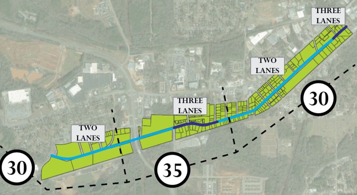
1st avenue Traffic
|
Roads are predominately two-lanes, with a short 0.2 mile three-lane section in the medical district and another 0.1 mile section at the far eastern end of the project area.
|
